
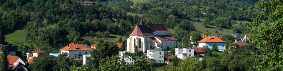
The town of Nova Bana is located in Central Slovakia, in the southwest part of the Banska Bystrica Region. It lies in the basin between two mountain ranges, Pohronsky Inovec and Stiavnicke vrchy (Stiavnica Mountains), which are separated by the River Hron. The dominant mountain range of this region is the Pohronsky Inovec (901 m a.s.l.), which spreads out between the Tribec area and Stiavnicke vrchy (Stiavnica Mountains). The elevation of the town is 221 m a.s.l. As at 31 December 2011 the town’s area covered 6,125 hectares and was home to 7,301 residents.
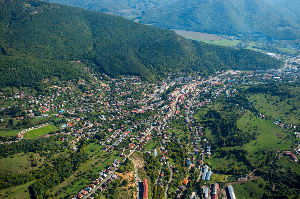
The town’s territory is very extensive, because a number of hamlets also belong to it and because it has a large number of relatively large-scale town lands. A unique feature of the Nova Bana peaks is their great segmentation. A typical element of this region is the crofts – scattered settlements in the town surroundings. Several hamlets whose origins are linked to the start of charcoal-making and woodcutting in this area also belong to the town.
Nova Bana is located on the main R1 Trnava – Banska Bystrica artery. Additional transport connections are via railway line no. 150 Zvolen – Nove Zamky and regular long-distance and local town-to-town bus connections. The nearest airport is at Sliac, 60 km away.
In terms of administrative structuring, Nova Bana belongs to the Banska Bystrica Region and the Zarnovica District (at present districts do not serve any administrative function, but they are a statistical unit on the level of the Nomenclature of Territorial Units for Statistics – NUTS IV). Within the district it acts as a balancing antipole to the district town of Zarnovica. Based on the number of residents (7,429 in 2005) the town can be considered as being in the category of smaller town seats.
In the surrounding settled areas, smaller to medium-large village communities exist which are associated in the Nova Bana microregion. The mission of the microregion is overall support for development of the area, the initiation of activities in the travel industry, with a focus primarily on rural tourism and agrotourism, preserving and protecting local cultural heritage, developing its natural and scenic value, reviving local traditions and customs and the like.
Nova Bana microregion covers an area of 23,600 hectares and is made up of the cadastral territories of the town of Nova Bana and the adjacent villages of Hronsky Benadik, Orovnica, Tekovska Breznica, Brehy, Voznica, Rudno nad Hronom, Velka Lehota and Mala Lehota. Upon entry to the microregion from the southwest, near the village of Hronsky Benadik, a completely different type of landscape scenery opens to the visitor. The plains and moderate downs are replaced by the richly segmented deciduous forests sharply dropping into the valley of the River Hron.